
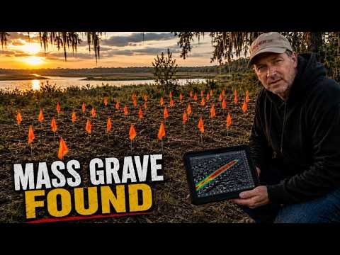
Ground penetrating radar uncovered a forgotten burial ground on a remote South Carolina rice plantation: unmarked graves, a lone overseer, and a massive burial trench that history left behind. Who were the people buried on this island, and why were they erased from memory?
We came out to this remote lowcountry island to do one small, respectful thing: use GPR to verify and map a single marked grave, a plantation overseer, the only named burial on the site. No fee, no agenda. The landowners asked, and we came because this history deserves it.
**The radar had other plans.**
Right beside the overseer (Slave Drive, the GPR returned a cluster of unmarked graves, individual burials we believe are family members, likely from the 1860s. People who lived and died on this island and were quietly forgotten.
**Then, a short distance away, the radar found something far larger.**
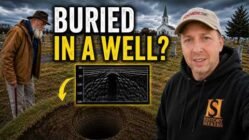
A long subsurface anomaly. A burial trench. What we suspect is a mass grave, holding many people at once. And the history of this place points to a heartbreaking explanation.
This island was a working rice plantation as far back as the early 1700s, built and sustained by enslaved laborers. In 1812, a brutal Yellow Fever epidemic swept the South Carolina lowcountry, claiming many enslaved lives on the region’s plantations. We cannot confirm the trench without excavation, and we will not disturb these graves to do it. But the evidence is hard to ignore.
**The clay caps may be the key.** Over the trench, the GPR detected distinct caps of heavy clay, a practice documented at other lowcountry archaeological sites through surveys like ours, where clay was packed over epidemic victims to contain disease before the sandy soil was replaced. The newer 1860s graves had no such caps. That single difference is what points us toward the older 1812 era for the trench.
These were almost certainly enslaved men, women, and children, buried without markers, their names lost to time. Helping to give that dignity back is the entire reason this channel exists.
———————————————
**Why are we not naming the location?** This is private land, and these graves are vulnerable. To protect the site from looters and trespassers, we will not disclose the island or the cemetery. Please don’t ask. Protecting these people matters more than any view count.
**What happens next is the part that gives us hope.** The landowners deeply respect this history. They plan to mark every newly discovered grave and build a protective fence around the entire site, so that everyone resting here, named and unnamed, free and enslaved, is honored and never to be disturbed.
———————————————
This is Just Beyond the Grave. We locate lost and unmarked graves using ground penetrating radar and deep historical research, and we tell the human stories the markers no longer can. No theatrics. No fake scares. Just the data, the history, and the people time forgot.
———————————————
💬 Who do you think they were? If you research lowcountry genealogy or African American history in this region and have insight into who these families might have been, I’d genuinely welcome it below. Do you believe the trench dates to the 1812 Yellow Fever outbreak, or could the clay caps tell another story? The discussion in the comments is part of how this history stays alive.
👍 If restoring dignity to the forgotten matters to you, hit LIKE. It genuinely helps more people find these stories.
🔔 SUBSCRIBE and turn on notifications so you’re here for the next discovery. Stay to the end for the full data analysis.
———————————————
📍 Location withheld to protect the site and the people buried there.
⚖️ All survey work is conducted with the landowners’ permission and full respect for the dead. We never excavate or disturb human remains. Our work is documentation, preservation, and dignity, nothing more.
#JustBeyondTheGrave #MassGraves #PlantationHistory


Add comment